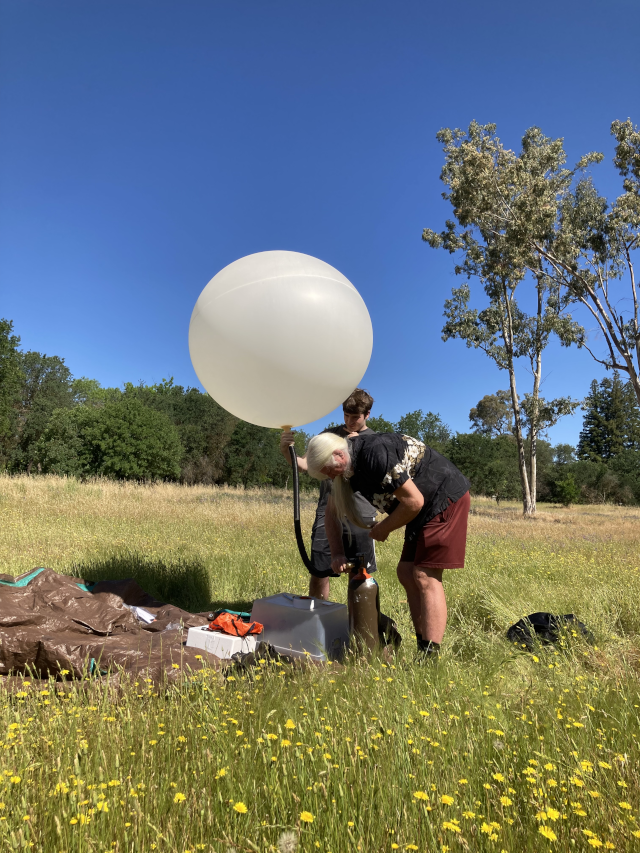
My now-adult younger son has been tossing around the idea of launching a weather balloon for a few months. I’d heard of doing such things, but didn’t know much about it. He’s been acquiring the sports camera, insulated box, balloon, parachute, and satellite tracking device. I offered to get some helium.
Yesterday was the day, and we went to a nearby open field on a beautiful, clear, still day and he assembled all the pieces. J attached the assembled payload package to the balloon. We filled the balloon with helium and let it go.
We put our gear away and got into the chase vehicle and…
Nothing. The transponder just kept showing the last ping from our launch site. We could see the balloon, however — the air was so still that it was rising almost vertically.
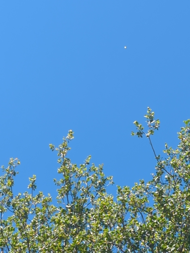
After a while, we still had no pings. The balloon appeared to be drifting off to the southwest as it rose, so we got in the car and drove a few miles. We stopped in a shopping center parking lot and found the balloon, now a barely-visible white dot far away in the sky.
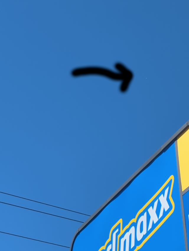
We watched it until I began to worry that someone might call the sheriff to report two strange people staring up at nothing in the sky. We knew that if we got in the car we were likely to never be able to spot it again, but we tried driving a few more miles southwest. Alas, still no pings and when we stopped again we were unable to spot the balloon.
Defeated, we drove home discussing in retrospect what we should have done differently. Better testing of the transponder after everything was assembled. Put human-readable contact information in the payload. Add a conventional tracking device like an AirTag or even a cheap cell phone that could relay image data. Those wouldn’t substitute for the satellite tracker, as the payload is often out of cell tower range, but they might have made it easier to locate after landing.
We don’t know what happened to our tracking, but there was a G5 solar flare yesterday which was more than sufficient to disrupt both GPS and the satellite backhaul.
We went home. I took a nap, and was awakened by a Signal message from J: the payload had just phoned home. It was about 90 km away and stationary! We took off in the chase vehicle.
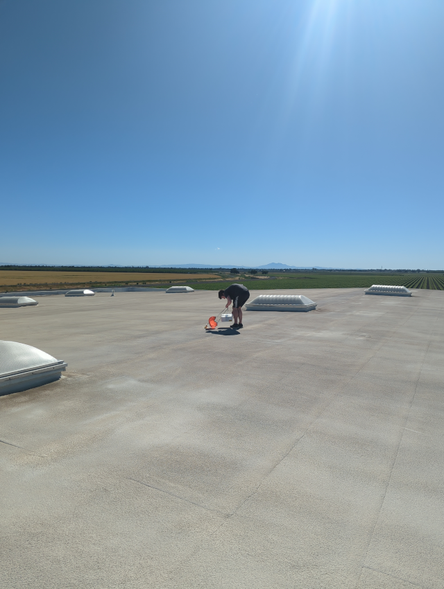
The coordinates took us to a wide-open agricultural area — good! — with a single large warehouse in the middle of it (uh, oh). The tracker showed our payload at the edge of the warehouse roof. Still in denial, we walked around the warehouse and inquired of some of the people working in it, but nobody would confess to seeing a white box plummeting to earth on a small parachute. One very kind person did point out that there was a ladder leading to the (at least 6 meter high) roof. We climbed…
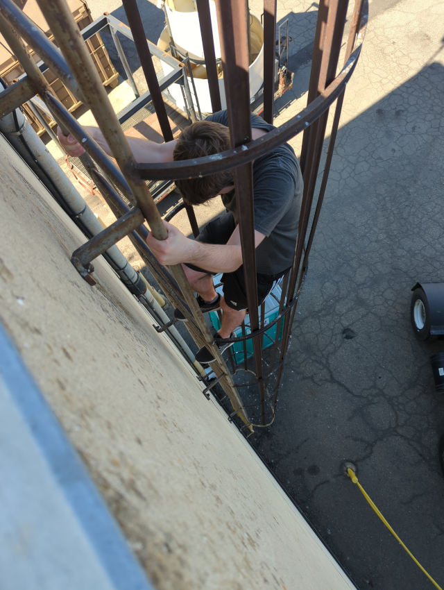
The ladder was, naturally, at the far corner of the roof from where we thought the payload might be. We crossed the huge roof, climbing yet another ladder to get to a higher level, then spotted the orange ‘chute!
Because it took us so long to recover, the camera had overwritten the beginning of the recording, but he got some great shots anyway.
—2p
Addendum 2024-05-24
Here’s a short (one minute) video of the launch. I’m traveling, so I can’t test how well it might work in various browsers. You might end up having to download it and play it in VLC.
Addendum 2024-06-07
I finally got into a video editor enough to make a couple of short clips of interesting moments.
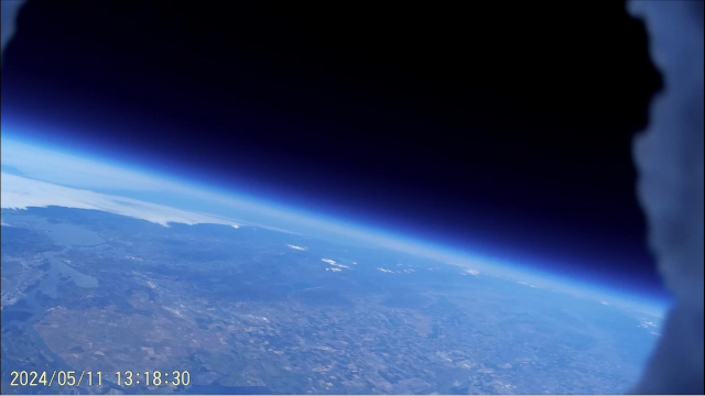
First, the balloon (presumably) at or near its apex, looking serenely across the Central Valley to the northern California coast. Then the balloon pops and the payload begins its whirling descent under its parachute:
Then, as the payload still spins under the parachute, you can see the vast agricultural plains and the ONE BUILDING where the camera decided to land:
Addendum 2024-06-22
Here’s an image from the balloon camera with an inset showing labelled satellite imagery.